Introduction to Bach Moc Luong Tu tourism
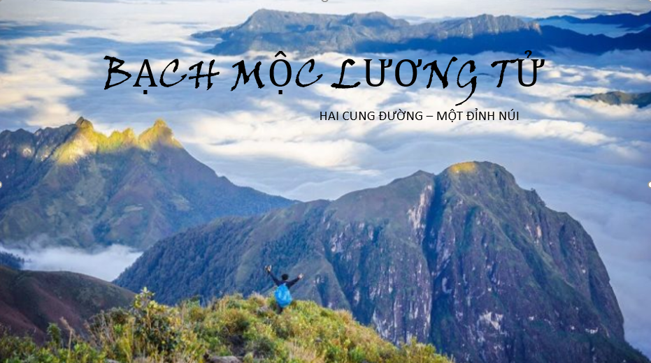 |
| Bach Moc Luong Tu is a high mountain with a sea of clouds surrounding the mountain, creating the most majestic beauty of the Northwest mountains. |
Bach Moc Luong Tu is a beautiful name that people give to the top of Ky Quan San. Bach Moc Luong Tu belongs to the natural boundary between 2 communes: Sin Suoi Ho (Phong Tho, Lai Chau) and Sang Ma Sao (Bat Xat, Lao Cai). Possessing an altitude of 3,046 m above sea level, this mountain was honored to rank 4th in the top 10 highest peaks in Vietnam.
For backpackers, conquering the 3,046m-high mountain is an attractive challenge. The attraction of this mountain peak lies not only in the experience of overcoming difficulties, but also because the view on the top of this mountain is extremely beautiful.
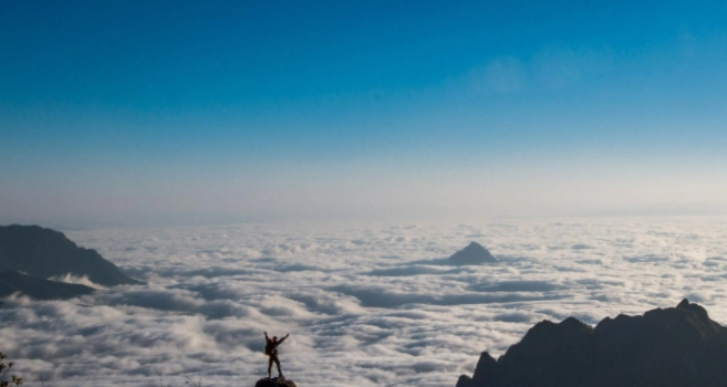 |
| Bach Moc with a truly majestic landscape. |
Bach Moc Luong Tu has been put into operation since 2012, until now Bach Moc Luong Tu has been widely known, becoming one of the extremely famous trekking spots, loved by many trekkers to hunt clouds.
The road to conquer the mountain has many difficulties, from high passes, deep abysses, steep cliffs to dangerous forests. In return, visitors will see the most beautiful clouds in the Northwest. The sea of clouds is thick and spreads all year round, especially at dawn on Muoi mountain – the passage through Bach Moc Luong Tu makes everyone fall in love and flutter.
How does Bach Moc Luong Tu travel experience?
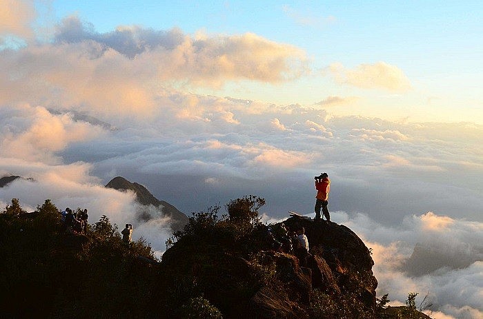 |
| The sea of white clouds billows on the top of Bach Moc Luong Tu |
How to go from Hanoi to Lao Cai and Lai Chau To conquer Bach Moc Luong Tu peak, visitors must first move to the foothills of Lao Cai or Lai Chau first. From Hanoi, visitors can choose to arrive by one of the following means of transport:
How to travel from Hanoi to Lao Cai
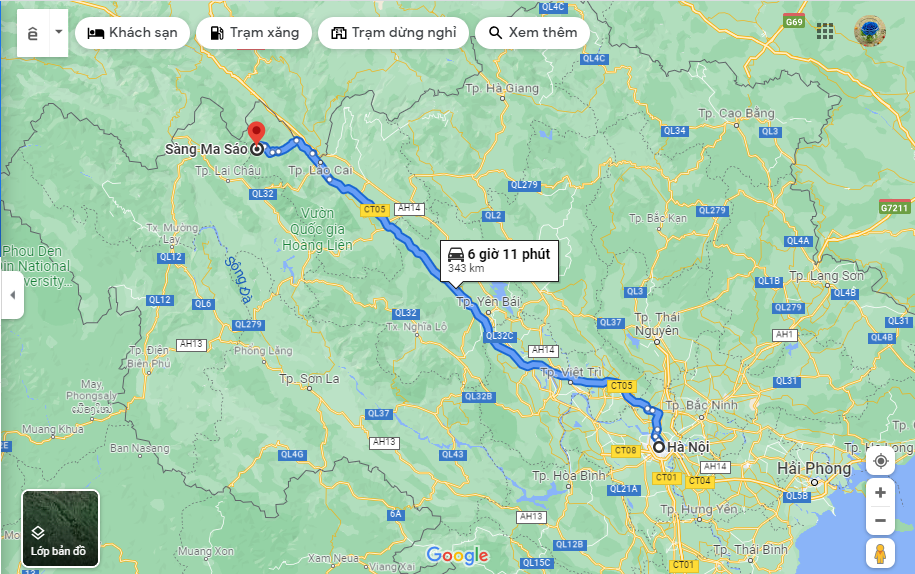 |
| How to travel from Hanoi to Lao Cai |
Bus: From Hanoi, visitors can catch a bus at My Dinh or Gia Lam bus station to Lao Cai or Sapa. Currently, Noi Bai – Lao Cai expressway has been put into operation, the distance is shorter and much more convenient. Ticket price for each leg is about 230,000 VND – 250,000 VND/way depending on the quality of the car. Visitors should preview the bus schedule and departure time to make a specific plan. It is better to take the midnight trip to reach the place around dawn, enough time for visitors to rest, eat something before starting the trekking journey.
At the latest, there is Sao Viet bus station, departing at 11pm from 779 Giai Phong, 7 Pham Van Dong or My Dinh bus station and arriving in Lao Cai around 3am the next morning.
 |
| Luxury bed car |
Traveling by train: Visitors to Hanoi station or book tickets online on the system to take the train to Lao Cai. Travel time is about 7-8 hours. Fares depend on the quality of the car, the type of hard/soft seat or the bed. Usually higher than passenger cars from several tens of thousands to hundreds of thousands. Likewise, visitors should take the trip in the evening.
If tourists move to Lao Cai by bus or train: After arriving in Lao Cai center, visitors can rent a motorbike (if traveling with few people) to go to Sapa town – Muong Hum market and then ask for directions to Sang. Ma Sao. However, if you go in a large group, you should rent a car to ensure safety, save money and not have to carry a lot of things. Rental price is from 1,600,000 VND – 1,700,000 VND/car 10 – 16 seats.
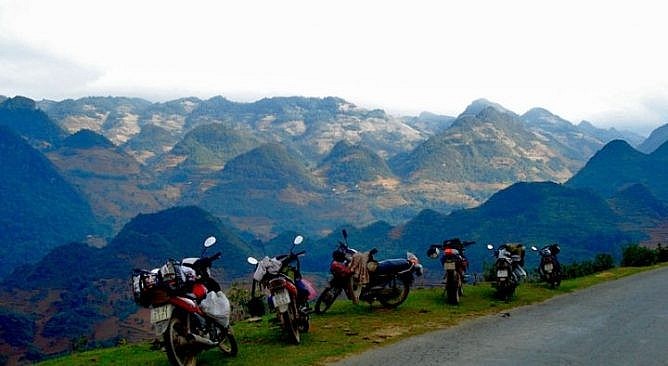 |
| Travel Sapa to enjoy the most exciting feeling |
Personal vehicles: Personal vehicles can be cars or motorbikes, in which motorbikes are the most chosen form of backpacking travel by young people. In this way, visitors can freely schedule, satisfy their curiosity and explore along the way. Visitors can choose one of the following two routes:
The first route (only for cars): Starting from the inner city of Hanoi, go up Thang Long bridge and then follow the Noi Ba – Lao Cai highway. On the way, visitors will pass through Vinh Phuc, Viet Tri, Doan Hung and Phu Tho provinces. Passing all these places is to Lao Cai.
The second route (for both cars and motorbikes): From the center, visitors go to Lang Hoa Lac located in the inner city, then will have to go to Highway 21 to reach Son Tay. Going up Trung Ha bridge is to Phong Chau and Doan Hung bridges of Phu Tho. From here, visitors just need to run along the road 70 to reach the territory of Lao Cai city.
How to move from Hanoi to Lai Chau bus station?
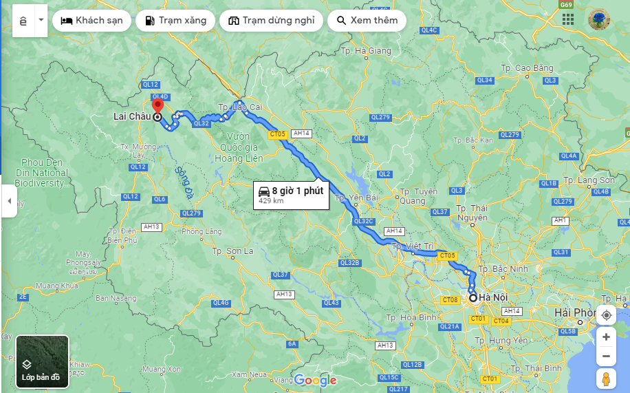 |
| How to move from Hanoi to Lai Chau bus station? |
Lai Chau is a little farther from Hanoi, about 450 km and visitors can also use a variety of means of transport to come here such as cars, coaches, motorbikes… guests can choose.
Bus: From Hanoi, visitors can go by car or catch a bus at My Dinh or Giap Bat bus station to Lai Chau. Currently, there are 10 bus operators on the Hanoi – My Dinh bus route, and at Giap Bat bus station there are also a number of companies that run routes to Lai Chau. Some bus companies can refer to such as: Hai Van, Khanh Thuy, Anh Tu, Ngan Ha, Hoang Anh, Bui Ngoc Dung, Cuong Phat, …
 |
Fares range from 200,000 VND to 350,000 VND/way. The journey takes about 12 hours. Visitors should consult and ask in front of the bus station about the stop in Lai Chau, see which stop is close and convenient to Bach Moc Luong Tu, then ask the driver to stop there.
By motorbike: From Hanoi, visitors follow Ho Tung Mau street, then go straight on National Highway 32 to the territory of Lai Chau province. Visitors should know the route schedule and ask the experience of those who have been on this road because this road is quite dangerous, with many dangerous sections.
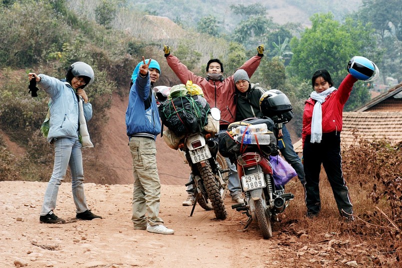 |
| Traveling by motorbike in Lai Chau is an interesting experience. Photo: Vntrip. |
Personal car: In case you like freedom, want to see and check-in the roadside scenery but cannot travel by motorbike, you can use a personal car. Starting in the center of Hanoi, visitors go from Thang Long bridge, then go to Noi Bai – Lao Cai highway, turn left on National Highway 279, continue going straight to the territory of Lai Chau province.
Or visitors can also follow the route of the motorbike above. In addition, according to Bach Moc Luong Tu Lao Cai travel experience, visitors can also take the train to Lao Cai and then take a bus for another 100 km to Lai Chau city. However, this way visitors have to rotate twice, which is quite time consuming and tiring. To Lai Chau, tourists take a motorbike taxi for about 300,000 VND to go to Den Sung village. From there, move on to the foothills of Bach Moc Luong Tu mountain.
Procedures for obtaining permission before conquering Bach Moc Luong Tu
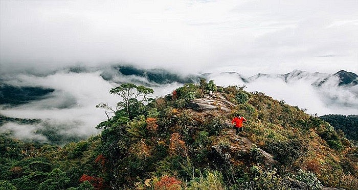 |
| Rich terrain, diverse vegetation, craggy cliffs. Photo: Tasting TV |
In addition to Phan Xi Pang and Pu Si Lung, if you want to go on a trip to Bach Moc Luong Tu, you need the consent of the management board or the border guard station. However, if you go from Lao Cao direction, you don’t need a referral at the moment. On the contrary, if going from Lai Chau, tourists must ask permission from the Provincial Border Guard Command, go there to apply for a permit and then report to the local border guard at Den Sung village. They may or may not agree, depending on the visitor’s ability to compromise.
What is the most suitable season to travel to Bach Moc Luong Tu?
 |
| Spring arrives on the top of Bach Moc Luong Tu |
Conquering Bach Moc Luong Tu peak, the most important thing for visitors to pay attention to is to choose the right time to limit the uncertainties on the way. Usually from about September to April next year is when the provinces in the North enter the dry season, the climate is changing seasons. Rarely rains, only occasional drizzle, does not affect roads and terrain.
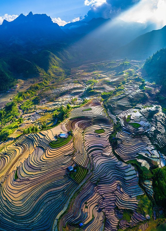 |
| Visitors have the opportunity to admire the beauty of the majestic Northwest mountains during their trip from September to April next year |
From February to April, this is the time when the Northern mountainous region enters spring. At this time, there is quite thick fog in Bach Moc Luong Tu, especially in late spring, the weather is drier.
Because it is less affected by cold air waves, there is no rain here or it only falls in the Central region or the North Coast. The air is fresh, around the trees sprouting, green and cool. If you go at this time, you will be able to see the petals of peach blossoms, ban flowers, plum flowers or brilliant rice flowers everywhere.
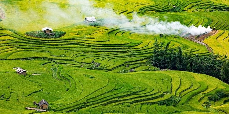 |
| Ripe rice fields you will encounter on the journey |
From September to November, this time in Bach Moc Luong Tu is entering autumn, which is said to be the most suitable time for climbing. The weather in early autumn is sunny, cool, and sere in late autumn. Especially almost no rain.
If tourists want to hunt for clouds, they should take advantage of this opportunity, the sun is light yellow, the sky is quite blue, the clouds are silver as brilliant as paradise. In addition, the sunrise on the top of Bach Moc Luong Tu in autumn is also more beautiful, visitors can also admire a valley of ripe golden rice winding at the foot of the mountain.
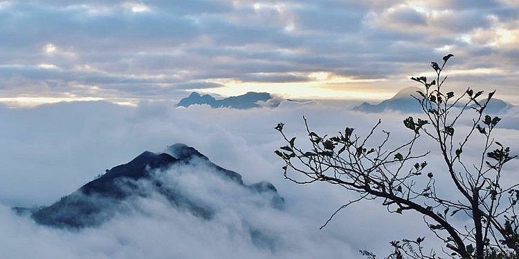 |
| Autumn is the time to hunt clouds at Bach Moc Luong Tu |
From December to January next year, in the northern mountainous provinces, besides clouds, there is a “specialty” of snow. For those who want to see the snow falling once, this mountain peak is an ideal suggestion. With a rare height, close to the Vietnam – China border, this place often snows every year. The panoramic view of the mountain filled with snow always makes backpackers, especially adventurers, want to conquer.
 |
| Dawn at Bach Moc Luong Tu |
However, the travel experience of Bach Moc Luong Tu, tourists should consider choosing a time that is suitable for their own health. If you choose the time of December or January, you will be able to see the snow. But the snow will cover the road white, difficult to determine the direction, and slippery. The cold also makes many visitors unable to move flexibly. If there is no snow, the journey is somewhat smoother.
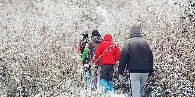 |
| Snow falls at Bach Moc Luong Tu |
Time not to go to Bach Moc Luong Tu: If from May to August is summer, dry and sunny in the Central region, in the Northern provinces, it is the rainy season. And like most other tourist destinations, choosing this time will not be very favorable.
With a lot of rain, the road will be slippery, especially with the steep mountain terrain, making it more difficult, hindering the conquest. Even the forest rains, flash floods are very likely to happen, causing danger to climbers. Therefore, even if you are an adventurous and challenging person, you should absolutely not choose these months.
A few things to know before climbing the mountain
To trek Bach Moc Luong Tu, there are 2 main routes, which are Lao Cai – Sapa – Sang Ma Sao or Lai Chau – Den Sung. So which route to choose, this is probably the question of many people when coming here.
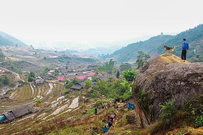 |
| Overview of the Sieve Ma Xao. |
The first route: Choosing a starting point from Ky Quan Quan village in Sang Ma Sao commune, Bat Xat district, Lao Cai province usually takes about 3 days and nights. Visitors can also take a bus (about 50 km from Sapa town) to Bach Moc Luong Tu. Or take a motorbike taxi, take a taxi along provincial road 155 to enter Muong Hum market and leave for Sang Ma Phao – this is the area at the foot of Bach Moc Luong Tu.
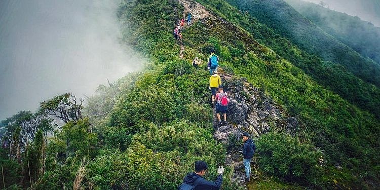 |
| Wind pass area at Bach Moc Luong Tu |
The second route: Going from Den Dung village, Phong Tho district, Lai Chau province, visitors will take about 4 days and 3 nights. After being in the center of the province, visitors continue for another 40 km to reach Den Sung village. With this road, visitors only need to go in a straight direction, so it is quite convenient.
Which road is convenient for trekking Bach Moc Luong Tu?
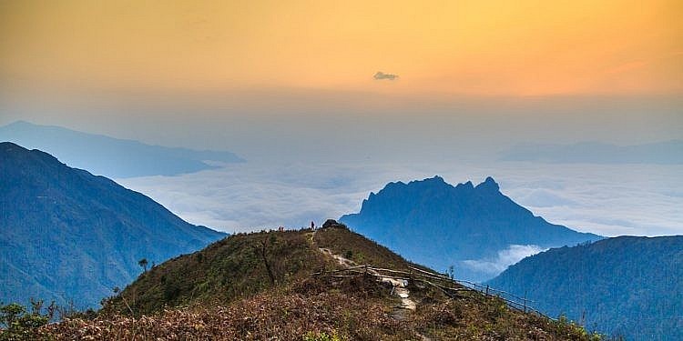 |
| The majestic and gentle beauty combined at Bach Moc Luong Tu |
Each different section of the road will bring visitors its own scenery and experiences. Choosing this direction, visitors will not be able to know what is special about the other road and whether it is beautiful and vice versa if you choose the other road. So if you have the opportunity to conquer Bach Moc Luong Tu mountain many times, you should try both. However, if you choose only one route, you should follow the route Mem Ma Sao – Bach Moc Luong Tu, because:
The road from Mem Ma Sao area is about 15 km long, there are many challenges that will be very suitable for tourists who love to explore and conquer. Climbing Bach Moc Luong Tu mountain, from Lao Cai, there are also burning forests, dry trees, many open spaces and many corners for visitors to take photos.
At an altitude of 2100 m, there are shacks to rest, where visitors can stop to rest, eat and prepare to go on. Especially at an altitude of 2800 m, it is considered to have beautiful scenery, even many people think that it is more beautiful than Bach Moc Luong Tu peak.
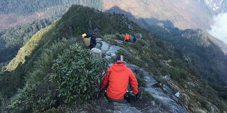 |
| Conquering Bach Moc Luong Tu – a death challenge for all Trekking people |
That is not to say that the road from Lai Chau is not attractive. For tourists who want to find a flatter terrain for convenience in moving, they can choose to go from Den Sung. On the way, visitors will experience the feeling of crossing the forest, wading streams, watching the mountains and forests with very diverse vegetation.
Should you use a tour guide to the top of the mountain when traveling to Bach Moc Luong Tu?
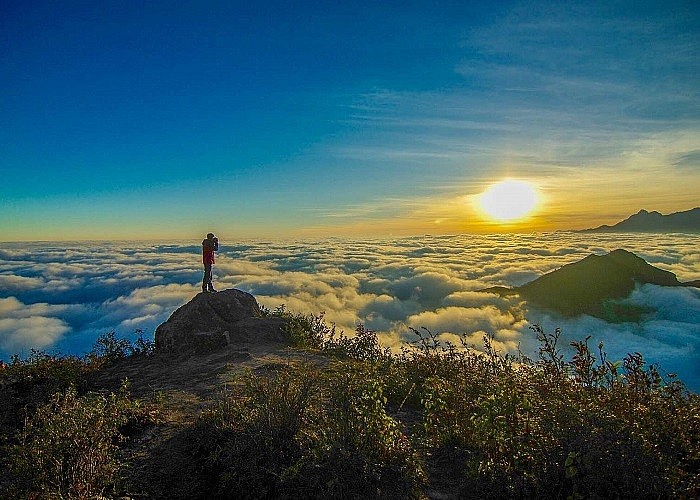 |
| Do not forget to prepare mentally before trekking to the top of Bach Moc Luong Tu. Photo:Youvivu |
Currently, if you want to climb Bach Moc Luong Tu, there are many tours for visitors to choose from. If you do not have experience and to ensure safety, visitors can refer to tours from tour operators or hire a guide (porter) for about 250,000 VND – 300,000 VND/day. They are knowledgeable about the terrain, climate and soil of the road, and are also in good health.
 |
| Flower season at Bach Moc Luong Tu |
The porter will lead the way, lead or lock the group under the guidance of the guide. At the same time, he is also the person who helps to carry luggage for tourists, cook rice and assist tourists during the journey. All porters are very friendly, approachable, although not too fluent in Mandarin but also understand what visitors say. In addition, if tourists have never climbed mountains before, they will also provide visitors with the necessary skills to ensure safety during the journey.
Conquering the top of Bach Moc Luong Tu
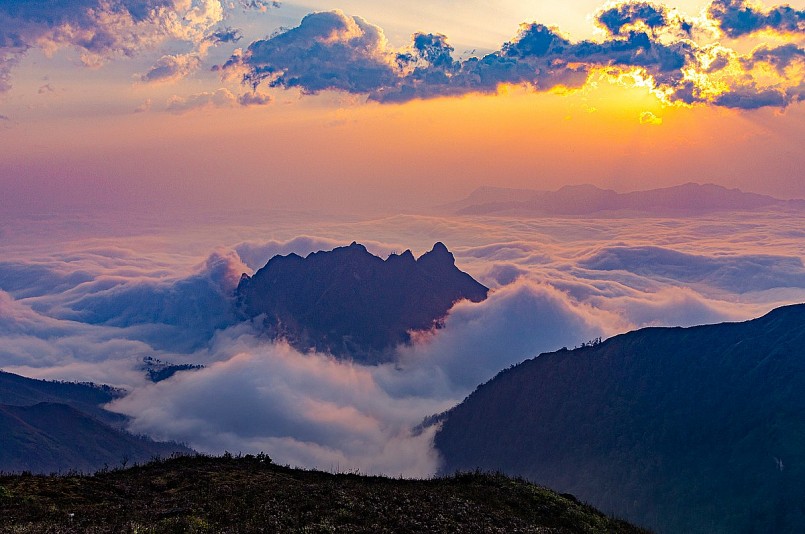 |
| Bach Moc Luong Tu is also one of the beautiful “hunting” places for clouds, attracting a large number of enthusiasts who are passionate about “moving” and trekking recently. |
Travelers should choose to depart from Lai Chau for an easier journey. To reach the top of the mountain, it is necessary to pass a forest road of about 30km with many bare hills, bamboo forests, cork forests and old trees between craggy cliffs.
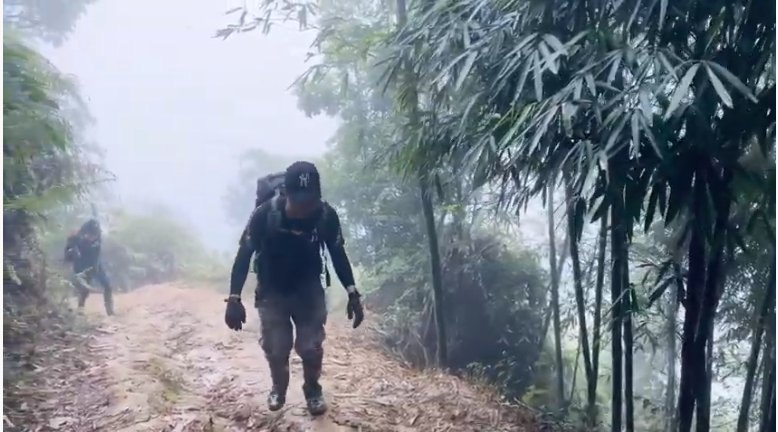
The first stretch of the road is quite steep and extremely difficult to walk. The terrain gradually became more difficult. The climber used both hands to hold on to climb up. The extremely difficult first distances are challenging for climbers. The majestic scenery of the mountains and forests urges the climbers to move quickly.
 |
| The swing is a new check-in point at Bach Moc Luong Tu |
After more than 8 hours of climbing with 15.5km of forest road, you can stop at a shack with an altitude of 2100m. In the shack, there is a place to eat and sleep and is compared to a modern five-star hotel located in the heart of the Northwest mountains. Guests will rest here to continue the journey the next day.
The next stretch of road will pass through slippery marshes and steep cliffs on the edge of deep precipices, steep cliffs. This section is mostly climbing, a few flat roads, not downhill. When tourists climb the mountain, they need to go steadily and keep their breathing steady. Be careful not to rest for too long and drink small sips of water.
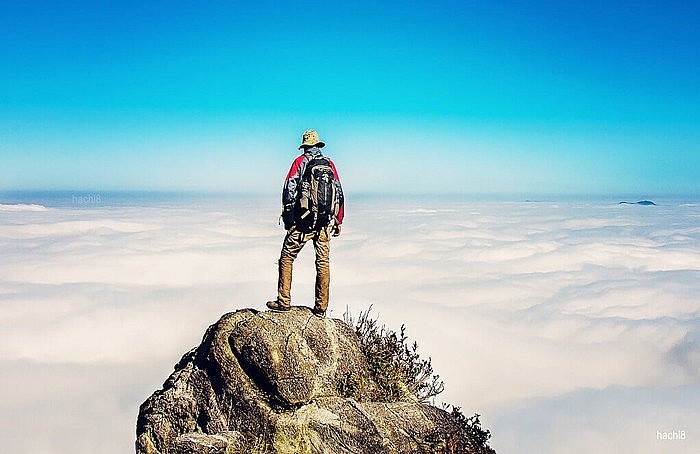 |
| Surrounded by only clouds and clouds. Photo: Hachi8 |
At the height of 2,840m is the peak of Muoi mountain floating in the clouds. Each cloud crept between the peaks and old forests, making visitors more motivated to go to the top of Bach Moc Luong Tu mountain. This is also a great check-in point. The top of Mount Salt is known as the most ideal cloud hunting spot for young people who love to move. This is also one of the tourist attractions when coming to Bach Moc Luong Tu.
From the top of Muoi mountain to the top of Bach Moc Luong Tu is the most exhausting journey for tourists. Through the bamboo forests, crawling on the mossy cliffs and then going through a trail, you will see the flag planted on the top of the mountain 3,046m high. That is the top of Bach Moc Luong Tu, also known as Ky Quan San.
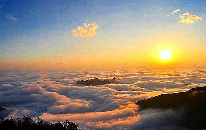 |
| Sunrise on the top of Bach Moc Luong Tu |
Reaching the top of the mountain, visitors will find the effort is extremely worth it. From the top of this mountain, looking far away, visitors can see both Phan Xi Pang or Lao Than… The space here can accommodate 80 people. The scenery from the top of Bach Moc Luong Tu is a gift for the climber’s hardships after a long journey.
Visitors can stay here for a night to watch the stars and the beautiful sunrise on top of the mountain to regain strength. And when going down the mountain, you can travel around Ky Quan San village at the foot of Bach Moc Luong Tu mountain.
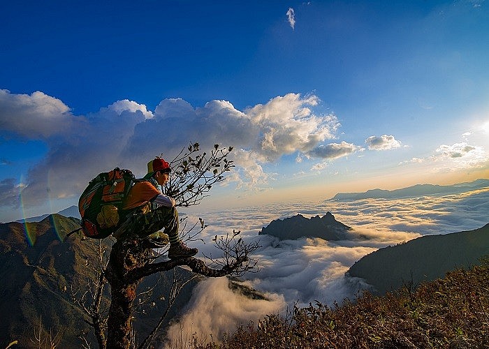 |
| Bach Moc Luong Tu peak is the peak of the Ky Quan San mountain range. Photo:Viettrekking |
What to eat when traveling to Bach Moc Luong Tu?
What to eat and where to sleep is probably the issue that tourists will be very interested in when planning to conquer this 4th highest mountain in Vietnam. With that said, this journey will last about 3 days 2 nights, more than maybe 4 days 3 nights. Visitors will have to eat and sleep on the mountain during this time.
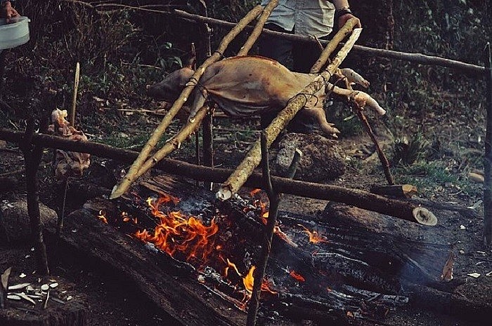 |
| You should prepare enough food for the climbing journey. Photo:northernvietnam_s_smiles |
According to the experience of going to Bach Moc Luong Tu, if the tourist group hires a porter, the porter will take care of the main meals for himself from preparing rice, food to cooking. However, visitors should actively contact 1-2 days in advance so they have time to prepare food and necessary utensils.
Most tourists coming here want to try grilled ginger chicken, especially in cold weather, these grilled dishes are extremely suitable. Guests like to be able to book in advance.
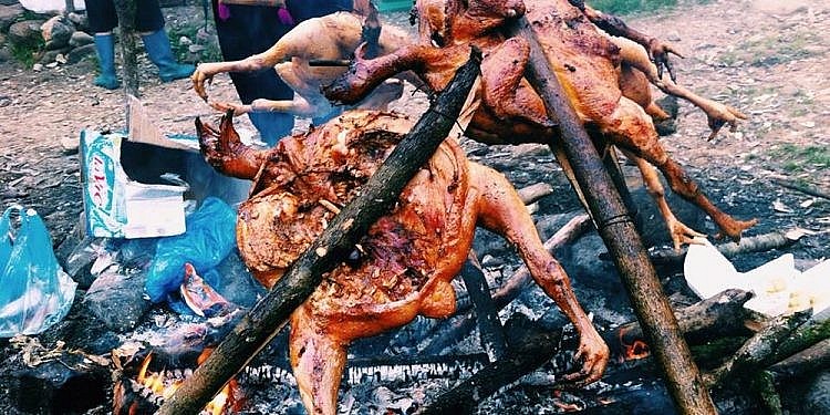 |
| Camping in the mountains will be fun |
In addition to rice and chicken, they also serve chicken porridge, egg noodles with cat eggs in the morning. If you want to eat something, you just need to book in advance, the cost of eating depends on the number of people eating, the dish that the visitor chooses.
Or visitors actively bring dry food such as bread, dry food, chocolate, rice cakes, milk, drinking water for temporary use, taking advantage of time to focus on moving.
Where to sleep during the journey to climb Bach Moc Luong Tu mountain?
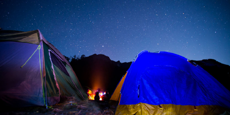 |
| Let’s rest and camp on the top of Bach Moc Luong Tu. |
Lao Cai Road: At the 2100 m point, there are several shacks built by people in the area with a capacity of about 50 people at the same time. The bed has been prepared with blankets and pillows, and the bottom has been lined with insulating foam sheets, so it is quite warm, visitors in autumn and winter do not need to bring sleeping bags. Instead, just prepare enough warm clothes, scarves, and woolen hats in case cold winds come rushing in at night.
Lai Chau Street: Visitors who choose to go this route should prepare enough tents and sleeping bags, because there are no shacks to stop at. But in return, the road will have some relatively flat terrain, where you can set up a tent to sleep overnight. To sleep in a tent, visitors also need to prepare a thin blanket, wear thick enough clothes and equip other accessories to keep their body warm.
What do you need to prepare before going to Bach Moc Luong Tu?
 |
| The attraction from the sea of clouds in the middle of paradise |
Traveling to the hills and mountains is not as easy as in the plains, visitors need to be well-prepared in all aspects from weather, psychology to luggage, etc. to ensure that there are no obstacles.
See the weather forecast before starting the trekking trip about 3-5 days, remember to monitor the weather forecast on the days that you plan to go so as not to affect the trip. This helps visitors to have reasonable preparation, and at the same time make the right decisions such as canceling tickets or canceling tours due to a rainy day or a landslide.
One thing that everyone knows for sure for trekking is health. This is not an experience for the sedentary, weak health. In addition, people with cardiovascular diseases, blood pressure … should not participate.
Therefore, in the days before climbing, visitors should exercise their physical strength with basic exercises such as jogging, walking, climbing stairs, … and replenish energy by eating well. The most important thing is to be mentally ready to face the difficult road.
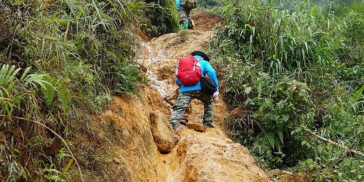 |
| Do not conquer the peaks in the rainy season. |
Based on the experience of climbing Bach Moc Luong Tu of those who went before, visitors should prepare specialized clothes for backpackers. Clothing should choose comfortable materials, dark colors, good elasticity, sweat absorption, contour lines in the sleeves, legs, neck to avoid insects flying on people.
If going in autumn, winter must definitely have more warm clothes, always make sure every part of the body is kept warm because the temperature on the top of the mountain is very low and extremely cold. Thermal clothing, thermal socks, towels, hats, earmuffs, gloves, etc., and it is not possible to wear climbing shoes with good friction. All are made of lightweight, waterproof materials to protect against light rain or dew. And during your journey, you will definitely have to sleep overnight, so prepare camping gear (tents, warm bags, vacuum mattresses, flashlights, jungle machetes…).
 |
| Fast food on the go |
The length of Bach Moc Luong Tu trekking route is 30 km and the trip will last from 3-4 days. Therefore, food is required.
There will be two main types: one to supplement nutrients when tired such as bread, confectionery, mineral water, electrolytes to help the body relieve fatigue, avoid blood pressure, sudden calcium drop.
The second type is food to eat full, can be lam rice, with chicken/grilled meat. Buy it or bring it up here to choose a barbecue camp. However, only bring enough quantity, do not bring too much because bulky and heavy luggage will make tourists exhausted, affecting the progress of the trip.
 |
| Equipment needed for trekking |
1 Climbing backpack (about >40 l is medium), remember to use the type with straps at both waist and chest. Fasten these 2 straps, the backpack will stick to the body, not shake or move during climbing.
Flashlight + backup battery: Power bank for electronic devices. If you go to Lao Cai road, even though there is electricity in the 2100m shack, it is only electricity that runs from the generator according to the power of the stream, so it is not stable, many users will be overloaded. The best option is to bring a few spare batteries for each person.
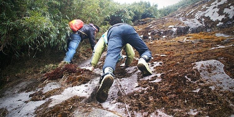 |
| The difficult road to Bach Moc Luong Tu |
Drinking water: If the weather is hot, an average person will run out about 1.5-2 liters of water per day. Visitors should buy a large quantity to spare for a few days, if it is too heavy, then divide it up and ask the porter to carry it for them to have enough water. On the 2100m shack also sells water but the price will be 3 times higher, visitors should consider to have a suitable plan.
Medicine: Some drugs such as headache medicine, stomach pain medicine, antiseptic, insect repellent, bandages… will be needed for visitors if they want to conquer a high mountain.
 |
| Winter mountaineering thermal clothing |
Specialized climbing equipment: Things that will help you get around easily: canes, a pair of climbing shoes with good grip, glasses with a strap (if you use glasses), lozenges to prevent neck dryness and a good backpack that won’t chip in the middle of the road. Don’t forget to bring a lighter, whistle, knife, watch, phone, and other items that can protect you on the way: hats, waterproof gloves, chapping wax, sunscreen, sleeping bags and tents (if visitors sleep overnight).
The beautiful scenery and sea of clouds on the top of Bach Moc Luong Tu are increasingly attracting the footsteps of young people who love to climb the mountain and love to explore the wild Northwest mountains. If you are looking to challenge yourself, what are you waiting for, do not prepare your luggage and go right to the top of the fairy mountain Bach Moc Luong Tu.
Source: Collected internet.
